
Living Ledger gives superintendents a digital field notebook that captures photos, GPS location, and conditions — all from your phone. Build an unbreakable record of what's happening on your course.
Your phone has hundreds of course photos — but which hole was that brown patch on? Last Tuesday or two weeks ago? Without context, photos are just clutter you'll never find again.
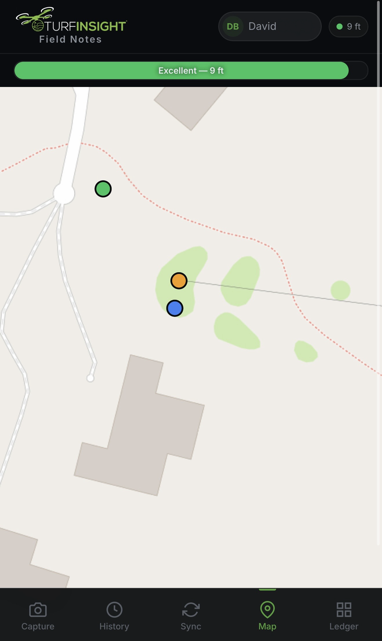
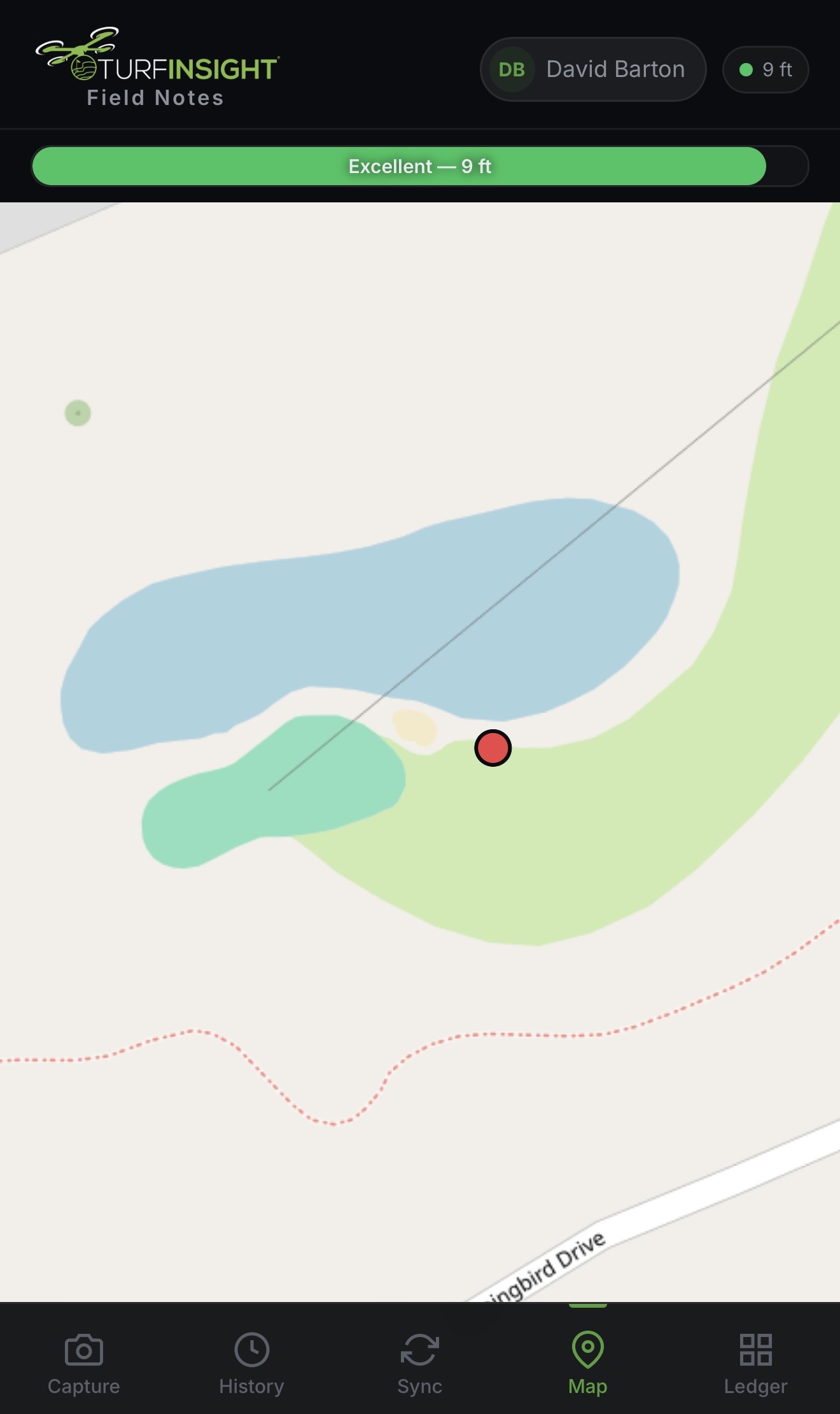
Without precise GPS coordinates, you can't prove where an issue was first observed or track how it spreads.
Board members want data and trends, not anecdotes. Show them evidence with photos, maps, and historical patterns.
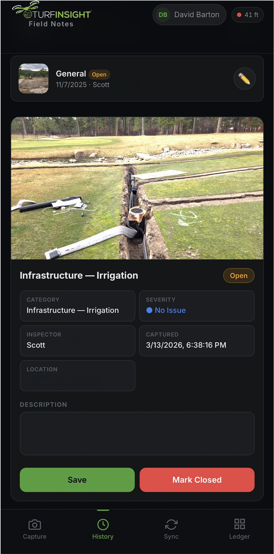
Snap a photo, tag severity and category, add notes. GPS location is automatic. Each observation takes 15 seconds.
See every observation plotted on your course map. Overlay with drone orthos, annotations, and design plans for the complete picture.
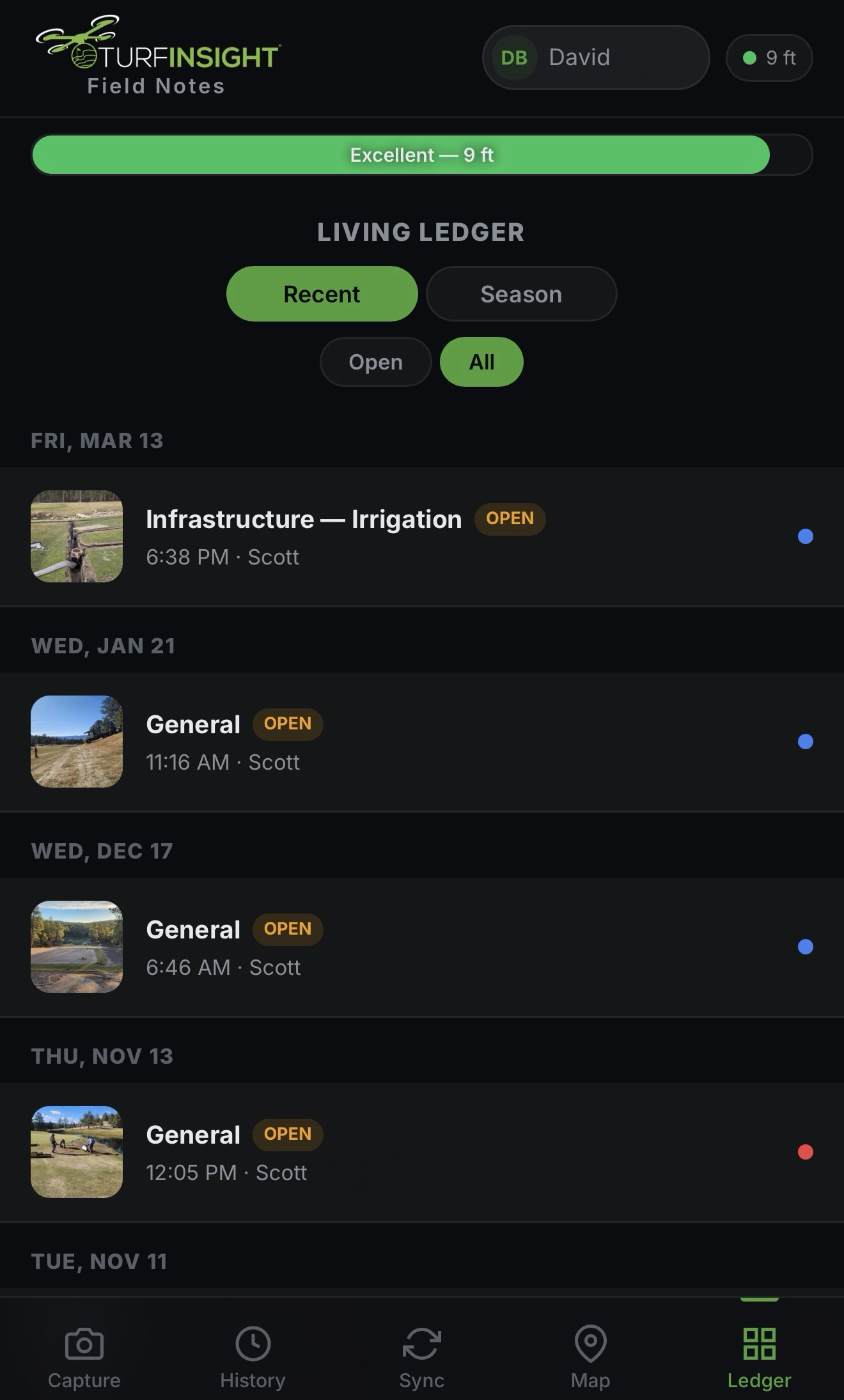
Week, month, and year views reveal patterns. Track fungus pressure, pest activity, and conditions across seasons.
Your entire crew can log observations — not just you. Every photo is automatically tagged with who, where, and when. Nothing falls through the cracks.
Create your account. We'll set up your course with your aerial base map so you're ready to go.
Open Living Ledger on your phone as you walk the course. Snap photos and tag conditions as you go — GPS is automatic.
View trends on your dashboard, share insights with your team, and export reports when the board asks questions.
Living Ledger is a standalone product — powerful on its own. For existing TURF Insight platform customers, it seamlessly integrates with our Living As-Built suite: overlay field observations on high-resolution drone ortho imagery, digitized course boundaries, elevation models, moisture analysis, and GPS sprayer integration. Ground truth meets aerial intelligence.
Join superintendents who are replacing clipboards with data-driven course management.
Get StartedBeta Access · No Credit Card Required